Map
Colonial Presence in Africa
Map of Africa in 1914 identifying colonial presence.
At a Glance
Language
English — USSubject
- History
- Genocide
- Racism
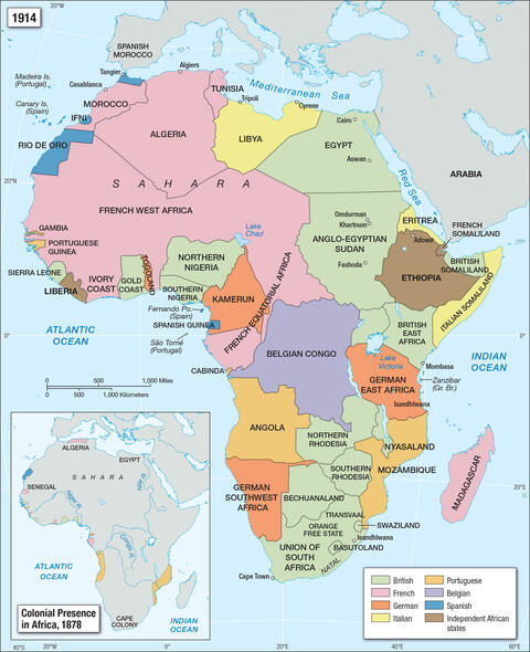
A Map of Africa in 1878 indicates far less colonial presence than the 1914 map. At the Congress of Berlin in 1884, 15 European powers divided Africa among them. By 1914, these imperial powers had fully colonized the continent, exploiting its people and resources.
Credit:
Facing History and Ourselves
Using the strategies from Facing History is almost like an awakening.
—
Claudia Bautista, Santa Monica, Calif


