Map
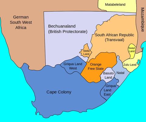
Map of South Africa Showing British Possessions, July 1885
This map illustrates territorial boundaries and colonial possessions in southern Africa in the late nineteenth-century.
At a Glance
Language
English — USSubject
- History
- Social Studies
- Democracy & Civic Engagement
Map of South Africa Showing British Possessions, July 1885

Map of South Africa Showing British Possessions, July 1885
Credit:
Courtesy of University of Texas Libraries, Perry-Castañeda Library Map Collection: Historical Maps of Africa
Most teachers are willing to tackle the difficult topics, but we need the tools.
—
Gabriela Calderon-Espinal, Bay Shore, NY


